
“Could you explain Global Positioning System (GPS) and Global Navigation Satellite System (GNSS) accuracy? What do they mean and how are they measured?” To do this, we have to discuss some statistical analysis theory. All GNSS manufacturers calculate accuracy the same way, but will often display different versions. The first thing to realize when discussing […]

Social Media Pages Since 1999, Tri-Global has been transforming the way field operations locate, inspect, and collect spatial data. Our innovations are derived from years of field GPS/GNSS inventories, inspection operations, and GIS data maintenance. Based on observations made within our own collection routines and off-the-shelf hardware and software from some of the industry giants, Tri-Global […]
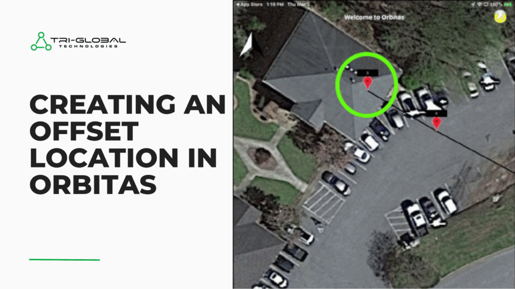
Here is what you’ll need for offset mapping Asteri Xi-Series receiver Orbitas Field license Measuring wheel or tape Internet access (data plan or wi-fi connection) for coordinate system calculations Creating your Offset Launch Orbitas Field and ensure you are connected to the X3i and it is tracking. Find a Location on the line (in a […]
Here’s a list of improvments to expect with the brand new version 2.2.1 of Orbitas RMS: Job Enhancements: Added flexibility and transparency Rename your job at your pleasure. Previously, once a job was uploaded, the job name was set permanently. Now, job names can be modified after initial upload. All DataOrbit™ jobs (not manually deleted from the […]
